Road Trips From San Francisco for Nature


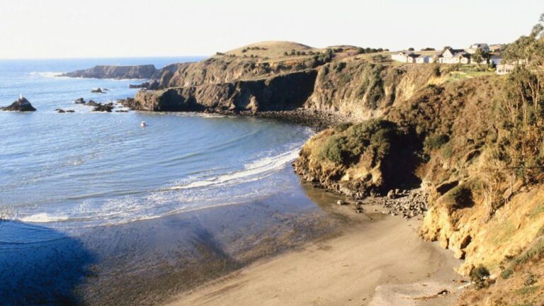
One of the best things about living in San Francisco is that you can drive just over one of the two bridges to a place entirely in nature that feels hours from the city. Here, we’ve listed the best road trips from San Francisco for nature reprieve just outside the city and beyond. Some are an hour away, while others require a longer drive.
Short Road Trips From San Francisco
These road trips are right outside the city. You can leave in the morning and be back for dinner! 😎
Muir Woods
📍 Driving Distance: 16 miles/about 40 minutes
🌐 Open in Google Maps

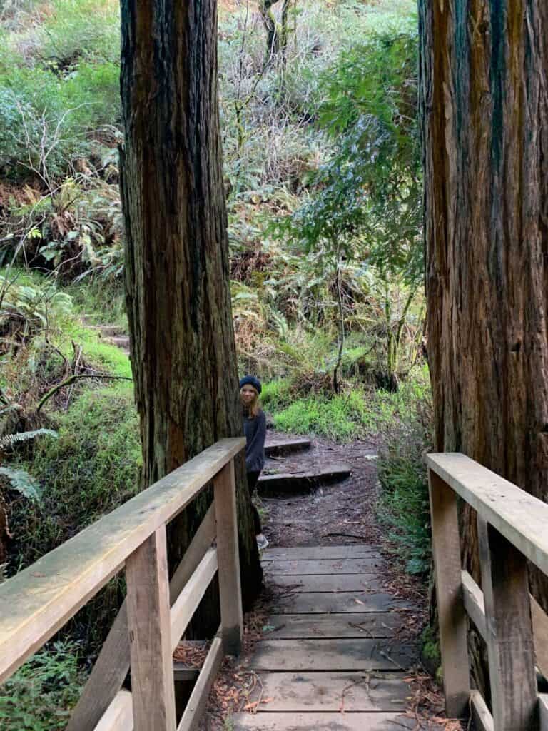
Muir Woods is an oasis right outside the city. A boardwalk weaves under giant Redwoods, which shade the area, so bring a jacket or sweater; it can get chilly here. You can spend hours here breathing in the fresh air before returning to the congestion of the city. Muir Woods is a great day trip from San Francisco and only requires a little planning.
Need to know: Parking reservations are a must; reserve parking here. The latest updates and conditions can be found here.
Point Reyes National Seashore
📍 Driving Distance: 40 miles/an hour and 15 minutes
🌐 Open in Google Maps
🆘 Latest updates here
📍 Driving Distance: 36 miles/about an hour
🌐 Open in Google Maps
🆘 Latest conditions and updates here
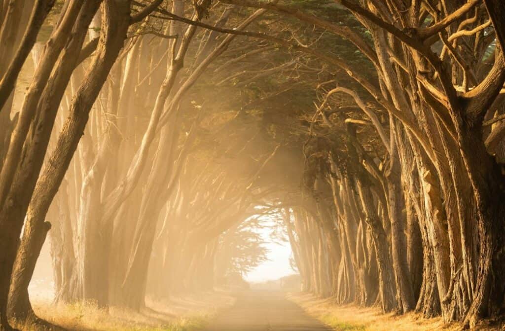
Probably best known for Cypress Tree Tunnel, where many engagement photos are taken, Point Reyes is a quick trip from San Francisco that will have you walking in nature for the day. It also offers one of the best places to watch whales migrate from January to March. Enjoy scenic coastal hikes that are easy to navigate.
Stinson Beach
📍 Driving Distance: 23 miles/about an hour
🌐 Open in Google Maps
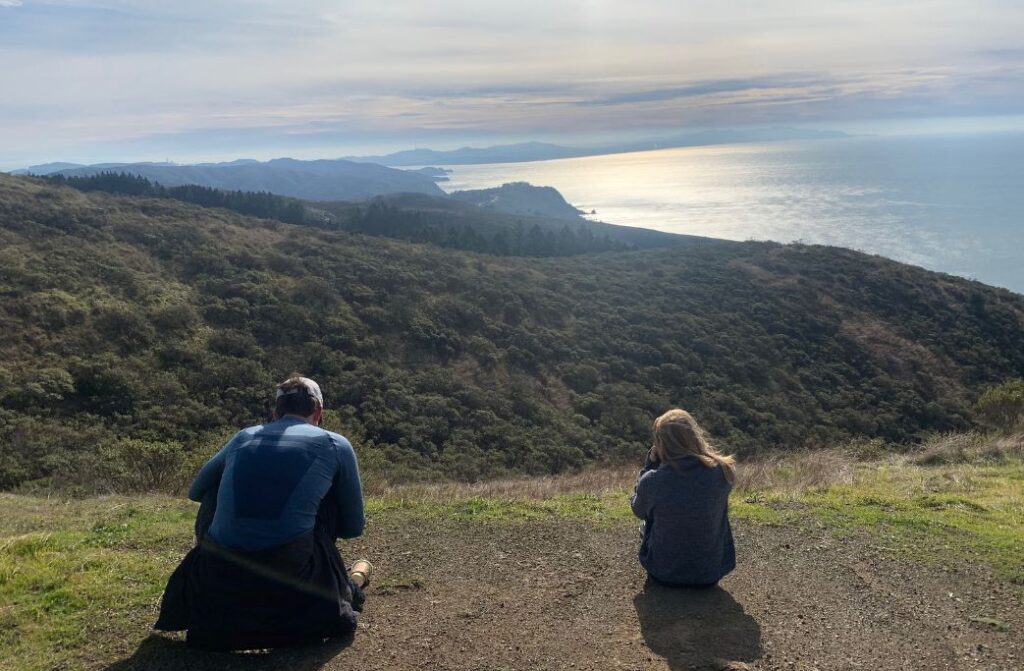
Even though Stinson Beach is only 23 miles north of San Francisco, it feels like you are worlds away here. Some of the best hiking can be found in Stinson. The hikes are moderate, and most begin on an incline but lead to breathtaking views of the Pacific Ocean. The drive out to Stinson is a windy one, but worth it.
Make sure to bring water if you are going to hike, then lay out on the beach or have lunch at one of the restaurants in town.

Need to know: There is no wifi here. For people who get car sick, this road will make you ill. But the views are worth it.
Road trips from San Francisco: Driving North
Now, let’s head north for the best road trips from San Francisco to see some nature you can do in one day.
Petaluma
📍 Driving Distance: 40 miles/about an hour
🌐 Open in Google Maps
The drive into Petaluma offers some of Northern California’s most beautiful landscapes.
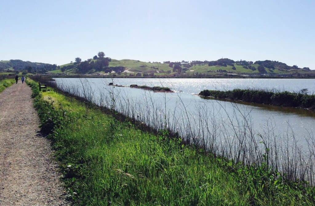
Once in Petaluma, head to Shollenberger Park, known for its flat, easy trails that circle a wetland area. It’s an excellent location for bird watching and leisurely walks, with trails suitable for all ages and fitness levels. It’s a great place to spend the day with the family, which gets you into nature and outside the city.
More information can be found here.
Bodega Bay
📍 Driving Distance: 70 miles/about 1.5 hours
🌐 Open in Google Maps
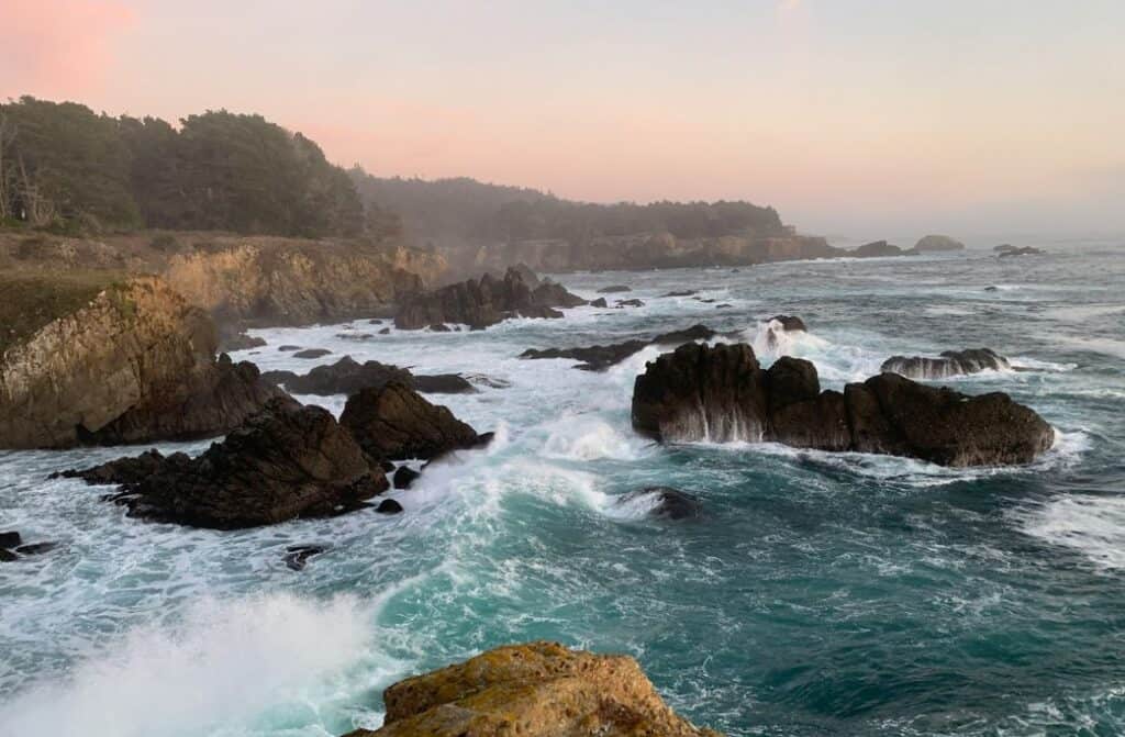
I’m partial to Bodega Bay; it has everything: film noir, great hikes, one of the best places to watch whale migrations, great restaurants, and a gorgeous landscape. It’s one of my favorite spots in Northern California.
Check out the Bodega Head Nature Trails, especially the West Trail (a short 1.2 mile loop), which is one of California’s best spots for grey whale watching from October to February.

Head here for more information about this charming coastal town. And here for the 7 Best Bodega Bay Hikes.
Lake Tahoe
📍 Driving Distance: 200 miles/about 3.5 hours
🌐 Open in Google Maps

A trip to Tahoe from San Francisco is fun all year round. There is so much to do in Lake Tahoe, including great skiing, hiking, and water sports. It’s gorgeous here. There are a dozen resorts in Lake Tahoe; our favorite is Squaw Valley at Alpine Meadows, and the views are stunning. But Lake Tahoe is gorgeous all year, whether you enjoy water sports or the snow.
Lassen Volcanic National Park
📍 Driving Distance: 236 miles/4 hours
🌐 Open in Google Maps
Lassen Volcanic National Park in California is a breathtaking destination where visitors can explore a stunning landscape shaped by the powerful forces of the earth, including steaming fumaroles, meadows dotted with wildflowers, and clear mountain lakes.
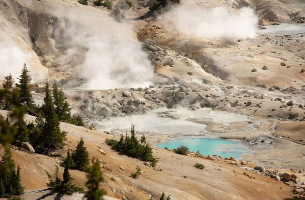
Its unique geothermal activity and the opportunity for hiking, stargazing, and learning about volcanic geology make it a must-visit. You can see the world’s four types of volcanoes: shield, composite, cinder cone, and plug dome.
To do: Hike the 5-mile round trip to Lassen Peak or explore the volcanoes and geothermal features.
Latest updates and conditions can be found here.
Road trips from San Francisco: Driving South
Pinnacles National Park
📍 Driving Distance: 123 miles/2.5 hours
🌐 Open in Google Maps
🆘 Latest conditions and updates can be found here.
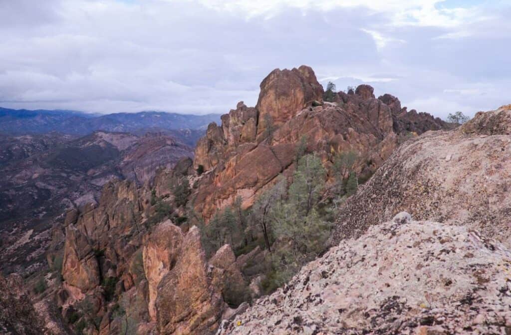
Pinnacles National Park, California’s hidden gem, is renowned for its dramatic landscape of towering rock spires and remnants of an ancient volcanic field. For rock climbing, Pinnacles is the park to check out. It offers rock climbing, cave explorations through talus caves, and sightings of the majestic California condors soaring above.
The park’s network of hiking trails leads adventurers through diverse habitats, spring wildflower blooms, and breathtaking high peaks, providing panoramic views of the surrounding wilderness.
Big Sur
📍 Driving Distance: 146 miles/2.5 hours
🌐 Open in Google Maps
🆘 Latest conditions and updates can be found here.
Note from Author: I just came back from Big Sur in March. Due to the heavy rains in California, there are road closures. Check the closures before you go, just so you know what you are in for.

We just went on the Ultimate Big Sur Road Trip in March. It was so much fun! I’ve driven the PCH often, starting from San Francisco and Los Angeles. Driving up or down the PCH in a convertible, with the music blasting is one of my favorite things to do.
Coming from San Francisco to Big Sur is the way to go. The turn-offs, where you park and check out the stunning Pacific Coast views, are all on the north-to-southbound side.
My favorite places to stop are Point Losos Park (make sure you hike to China Beach) and Pfeiffer Beach with its “purple” sand. Make sure to check our Keyhole Arch on Pfeiffer Beach.

Don’t miss the Big Sur Bakery for its ginger scones, rich mocha cookies, and cream-filled donuts. End the day at Nepenthe for a cocktail and dinner. AH, I want to go back to Big Sur already.
Death Valley National Park
📍 Driving Distance: 475 miles/8 hours
🌐 Open in Google Maps
🆘 Latest conditions and updates can be found here.

Death Valley has been in the news lately because, as of this writing, a lake has formed in the middle of it due to the heavy rains California is getting. A lake in the middle of Death Valley National Park is highly abnormal.
To explore the mesmerizing landscapes of Death Valley National Park, the best thing to do is visit Badwater Basin, the lowest point in North America. The vast salt flats create a surreal, otherworldly vista against the towering mountain backdrop. And now, it has water on it, although this won’t last long.
Joshua Tree National Park
📍 Driving Distance: 499 miles/8 hours
🌐 Open in Google Maps
🆘 Latest conditions and updates can be found here.
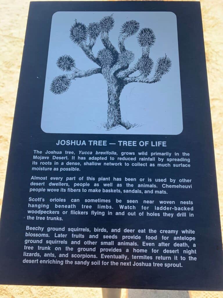
Joshua Tree National Park is among the most underrated national parks I’ve ever visited. I love this park; there is something about it, I think I’m energetically aligned with Joshua Tree.

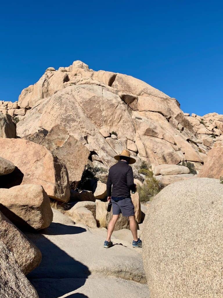
We often rent an Airbnb outside the park and spend our days hiking and our nights by an outdoor fire, drinking wine while looking at the stars. You can see all the stars from Joshua Tree. There are so many easy hikes here, like Keys View, Hidden Valley, and Skull Rock; check out our Ultimate Joshua Tree One Day Itinerary.
Road trips from San Francisco: Driving East
Mt. Diablo State Park
📍 Driving Distance: 40 miles/1 hour 15 minutes
🌐 Open in Google Maps
🆘 Latest conditions and updates can be found here.
Mt. Diablo State Park is a short drive east of San Francisco, so it makes for a great day of hiking and an early drive back.

With many trails catering to all levels of hikers, Mt. Diablo State Park ensures that everyone can enjoy a breathtaking view of San Francisco from the summit, whether they hike all the way to the summit or drive most of the way up and walk the last ten minutes. It’s perfect for the whole family.
Yosemite National Park
📍 Driving Distance: 170 miles/3.5 hours
🌐 Open in Google Maps
🆘 Latest conditions and updates can be found here.
You could spend a week in Yosemite and still not see everything. Hiking in Yosemite National Park is an unparalleled experience, where every trail unfolds into the majestic beauty of towering granite cliffs, ancient sequoias, and thunderous waterfalls cascading into crystal-clear streams.

Among the many trails, a few stand out for their breathtaking waterfall views. The Mist Trail, arguably the most popular, offers an up-close encounter with Vernal and Nevada Falls, enveloping hikers in a refreshing mist.
Another gem, the Lower Yosemite Fall Trail, provides a leisurely walk with stunning views of Yosemite’s tallest waterfall.
For those seeking a more strenuous hike, the Upper Yosemite Falls Trail challenges hikers with its steep ascent, rewarding them with spectacular vistas of the valley and the thundering waterfall from above.
These trails, each offering a unique perspective of Yosemite’s waterfalls, embody the awe-inspiring beauty that calls adventurers back to this iconic park year after year.
Sequoia and Kings Canyon National Parks
📍 Driving Distance: 238 miles/4.5 hours
🌐 Open in Google Maps
🆘 Latest conditions and updates can be found here.
I love giant Sequoias; Sequoia and Kings Canyon National Parks have the largest ones in the world. Check out the Giant Sherman Tree in Sequoia National Park and the General Grant Tree in King’s Canyon, two of the largest and widest trees in the world.

Don’t forget to check what’s open before you leave home on a road trip, including roads, visitor’s centers, bathroom facilities, etc. Need some packing guidance? Check out my California Road Trip Essentials list — I’m constantly updating it with new recommended equipment!
California Travel Planning Guide
🚑 Should I buy travel insurance for California?
100% YES! – With basic coverage averaging $1.50 USD per day, enjoy peace of mind with a plan from SafetyWing, one of the biggest names in travel insurance. (Read more)
💦 Can you drink the water in California?
Yes — But I wouldn’t. It doesn’t taste very good and there are contaminants in it. You’ll want to buy a Water-To-Go Bottle, which filters drinking water while on the go (traveling) and helps keep you hydrated.
🚙 Is it safe to rent a car in California?
Yes — Renting a car in California is one of the best ways to explore this vast, awesome state, and kind of a must! I always rent with Discover Cars, which checks both international companies and local California companies, so you get the best rates. (read more)
🏨 What’s the best way to book my California accommodations?
For California hotels, Booking is the best site, but for hostels, use Hostel World. If you’re considering a California Airbnb, don’t forget also to check VRBO, which has better rates than Airbnb.
🧳 What do I pack for California?
Head to the Ultimate California Packing List to get all the information you need about packing for a trip to California.
🛫 What’s the best site to buy airfare to California?
For finding cheap California flights, I recommend Skyscanner.